

Itineraries
Itinerary II – Holy Trace
From Ballsh to Cerrilë through ancient oaks, mountain views and a sacred rock
- Difficulty (1–10)
- Moderate
- Distance
- 22.5–26 km
- Duration
- Full day (4–6 hrs)
- Elevation
- 200–708 m
Linear route from Ballsh to Cerrilë (Bardhaj). Easy by car, moderate by bike, challenging on foot for the full route. The final 500 m to the Holy Trace are on foot.
The Holy Trace itinerary is a moderate, full-day cultural and natural route of about 22.5 to 26 kilometres. It runs from the town of Ballsh to the village of Cerrilë (Bardhaj) in Mallakastër, southern Albania, passing through Panahor, Aranitas, Gjerbës, Selitë and Bardhaj.
The route combines paved and reconstructed mountain roads with short walking trails. It reaches a maximum elevation of 708 metres, with slopes ranging from gentle to steep. The final ascent on foot to the Holy Trace is the most demanding part.
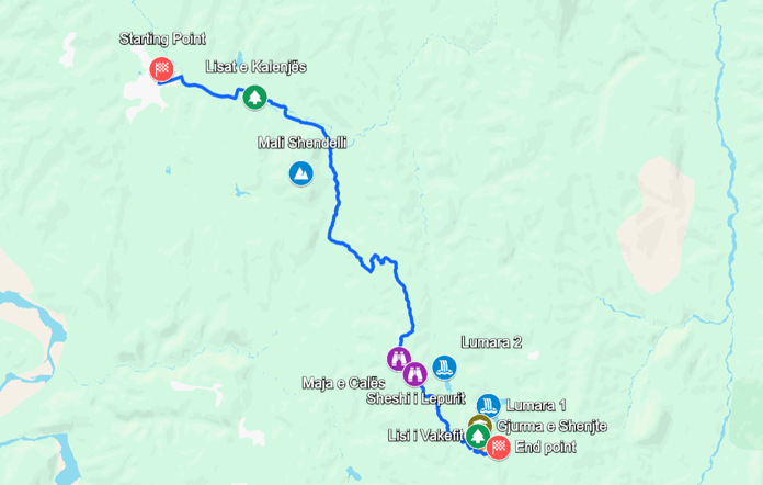
Along the way, visitors encounter five points of interest that weave together nature, legend and spiritual heritage: the ancient oaks of Kalenjë, the panoramic heights of Mali Shëndëlli, the views over the Lumara lakes, the sacred rock of the Holy Trace and the centuries-old Vakëf Oak. The route is at its best in spring and autumn, and rewards travellers with dramatic landscapes, rare natural monuments and a living tradition of pilgrimage.
The route, step by step
- Ballsh — start in the town centre
- Panahor — the Oaks of Kalenjë
- Aranitas — Mali Shëndëlli
- Gjerbës
- Selitë — the Lumara lakes and the panorama over the hills
- Bardhaj / Cerrilë — the Holy Trace and the Vakëf Oak
From about 200 m in Ballsh, the road climbs more than 500 m to a maximum of 708 m. The walking section to the Holy Trace is about 500 m long, unpaved and steep in places, with slopes of up to 18.8°.
Difficulty by segment
| Segment | Difficulty | Notes |
|---|---|---|
| Ballsh → Panahor → Aranitas, paved road | Easy | Good road, gentle slopes, suitable for any vehicle |
| Aranitas → Gjerbës → Selitë, mountain road | Moderate | Winding reconstructed road, steep sections up to 14.7°, climbs to about 708 m |
| Selitë → Bardhaj / Cerrilë, road | Moderate | Hilly terrain covered in strawberry trees |
| Cerrilë → Vakëf Oak → Holy Trace, on foot | Moderate–challenging | About 500 m, unpaved, through pine forest, slopes up to 18.8° |
Time and difficulty by transport
| Mode | Time | Difficulty | Notes |
|---|---|---|---|
| Car | 1.5–2.5 hrs | Easy | Whole route drivable, plus 15–30 min at each stop; the last 500 m are on foot |
| Mountain bike | 3–4.5 hrs | Moderate | Significant climbing; you may need to push the bike on steep sections |
| On foot, full route | 7–9 hrs | Challenging | About 26 km with more than 500 m of climbing |
| Car and walking | 4–6 hrs | Easy–moderate | Drive to key points, walk to each site — recommended |
Best for: cultural heritage enthusiasts, nature lovers, photographers, spiritual seekers and moderate hikers.
Practical tips
- Best season: spring (April–June) and autumn (September–October), with mild temperatures and green landscapes
- What to bring: hiking shoes, at least 2 litres of water, sun protection, a hat, snacks, a camera and binoculars
- Fuel and supplies: fill up in Ballsh; services in the villages are limited, so carry enough water and food
- Road conditions: reconstructed roads to Gjerbës and Selitë; the final section to Cerrilë is rougher
- Signage: limited, so use GPS or the map on this page
- Local guides: recommended for the spiritual and historical context; ask in Ballsh or Cerrilë
- Mobile coverage: may be patchy in remote areas, so download offline maps
- Where to stay: options are limited in the villages; Ballsh and Berat are the best bases
Please be respectful. The Holy Trace is a sacred site. Dress modestly, keep your voice down and ask before photographing worshippers.

Strengths
Spiritual and cultural heritage
- The sacred rock of the Holy Trace, with its legendary footprint and links to the Halveti Sufi tekke of Cerrilë
- A living tradition of pilgrimage and local memory
Nature and landscape
- The ancient oaks of Kalenjë and the centuries-old Vakëf Oak, rare natural monuments
- Panoramic heights of Mali Shëndëlli above Aranitas
- The artificial Lumara lakes and the hills of Mallakastër
- Pine forest and hills covered in strawberry trees
Practical
- Paved and reconstructed mountain roads, with short walking trails
- Can be done by car, mountain bike or on foot
- Accommodation in Ballsh or in the nearby city of Berat
1 / 33
-
The Hills of Mallakastër and the Lumara Lakes
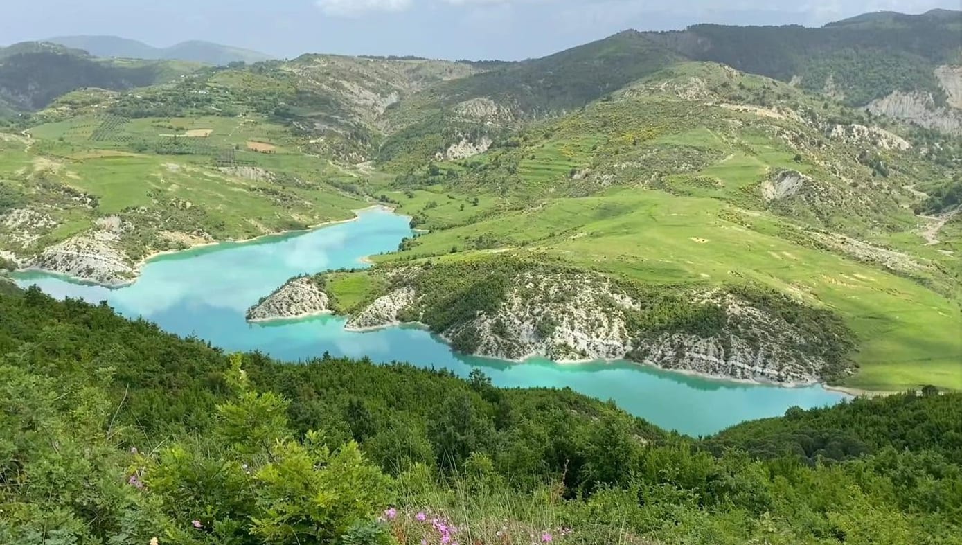
Sweeping views over the hills and the artificial lakes Lumara 1 and Lumara 2, between Gjerbës and Selitë.
Read more → -
The Holy Trace
A sacred rock with a legendary footprint, linked to the Halveti Sufi tekke of Cerrilë. Reached by a 500 m walk through pine forest.
Read more →


